• Vendu
THE AMERICAN CONTINENT, topographical and railroad map of the United States, by Haasis &Lubrecht 1868
  • THE AMERICAN CONTINENT, topographical and railroad map of the United States, by Haasis &Lubrecht 1868
  • THE AMERICAN CONTINENT, topographical and railroad map of the United States, by Haasis &Lubrecht 1868
  • THE AMERICAN CONTINENT, topographical and railroad map of the United States, by Haasis &Lubrecht 1868
  • THE AMERICAN CONTINENT, topographical and railroad map of the United States, by Haasis &Lubrecht 1868
  • THE AMERICAN CONTINENT, topographical and railroad map of the United States, by Haasis &Lubrecht 1868
  • THE AMERICAN CONTINENT, topographical and railroad map of the United States, by Haasis &Lubrecht 1868
  • THE AMERICAN CONTINENT, topographical and railroad map of the United States, by Haasis &Lubrecht 1868

THE AMERICAN CONTINENT, topographical and railroad map of the United States, by Haasis &Lubrecht 1868

des estampes du XVI ème siècle au début du XIX ème siécle

Quantité
Vendu

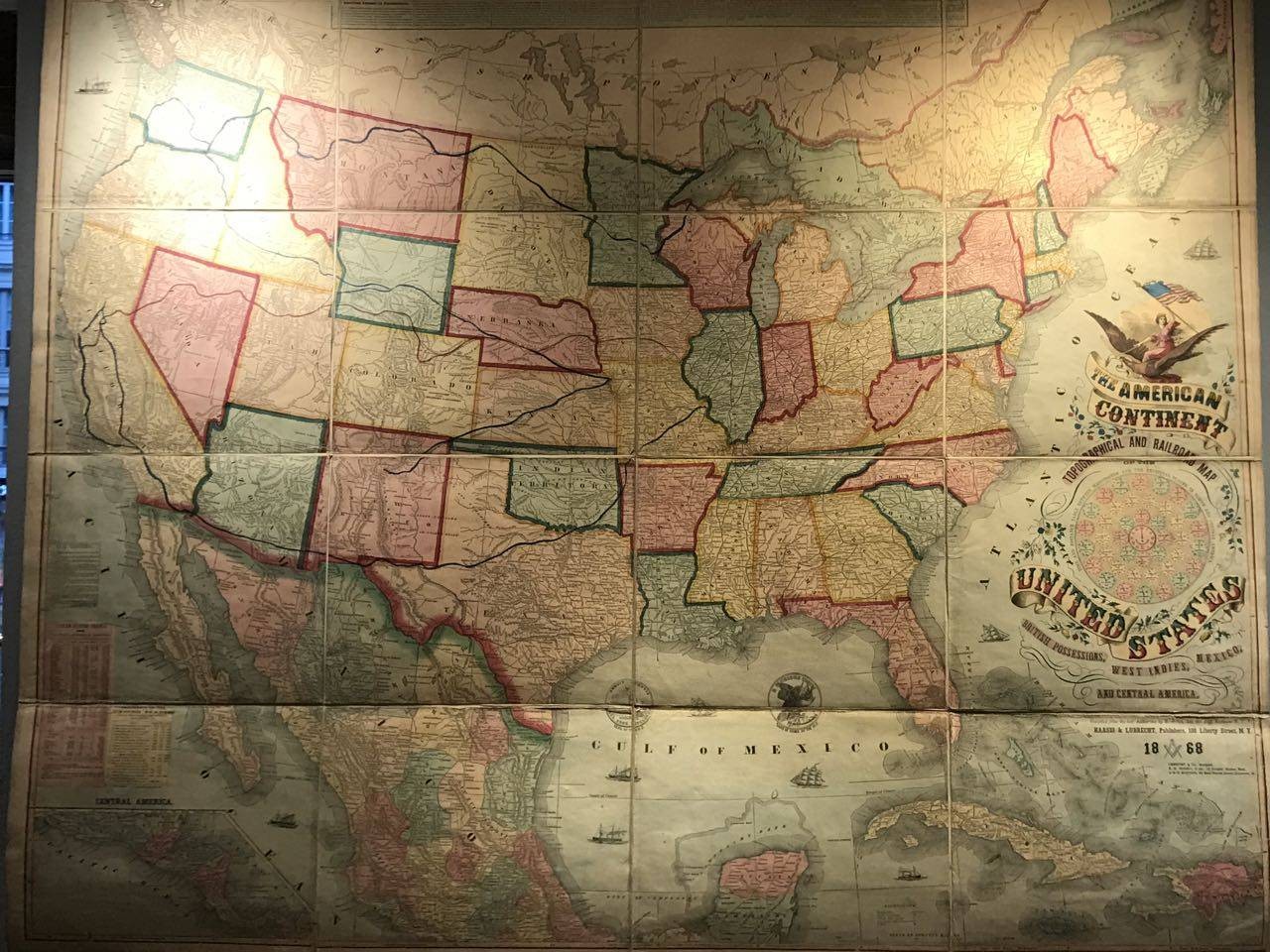
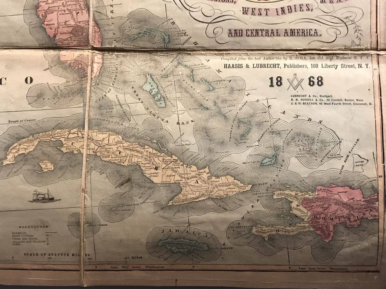
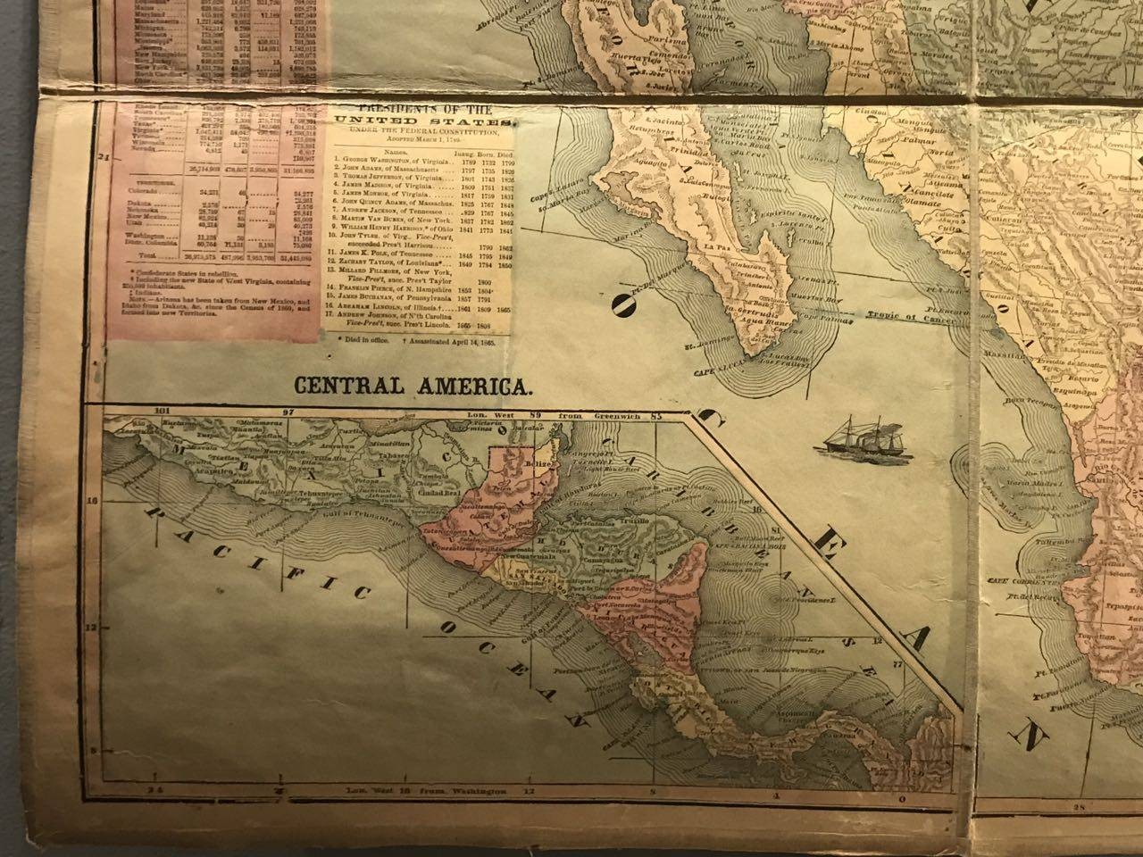
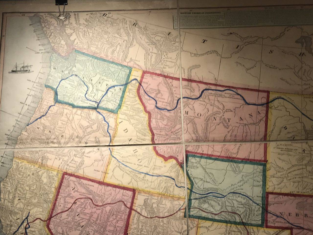
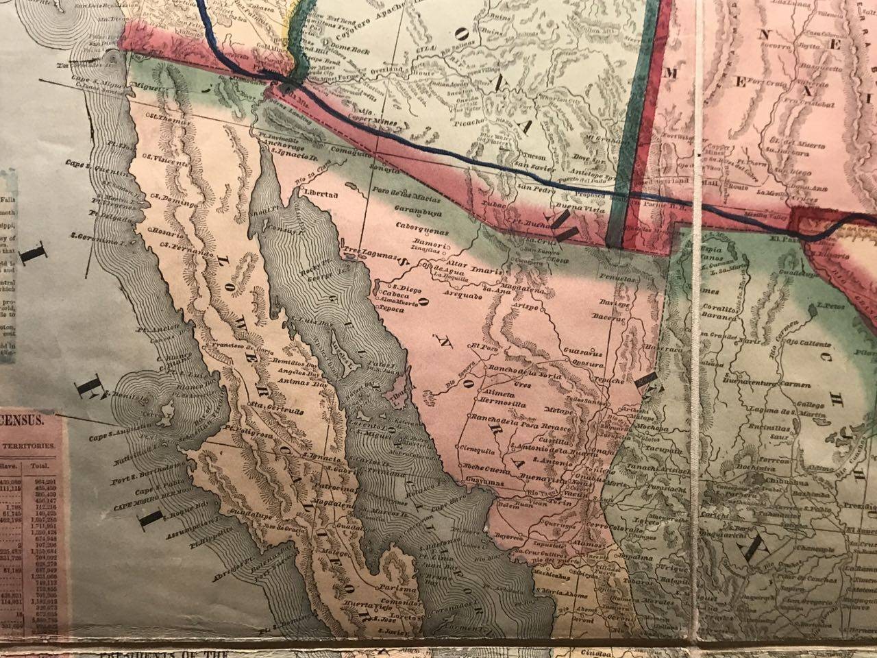
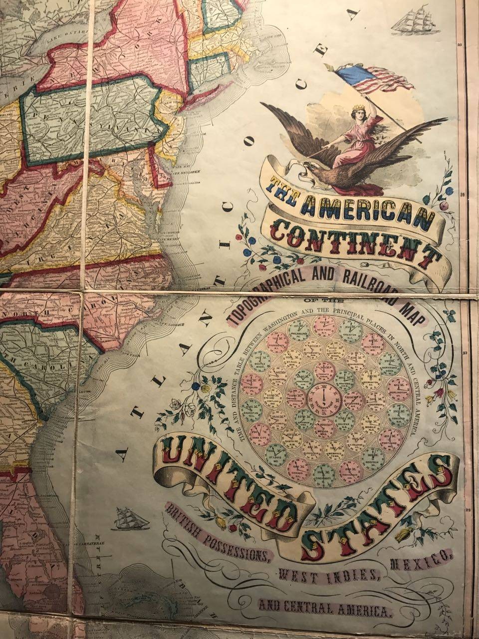
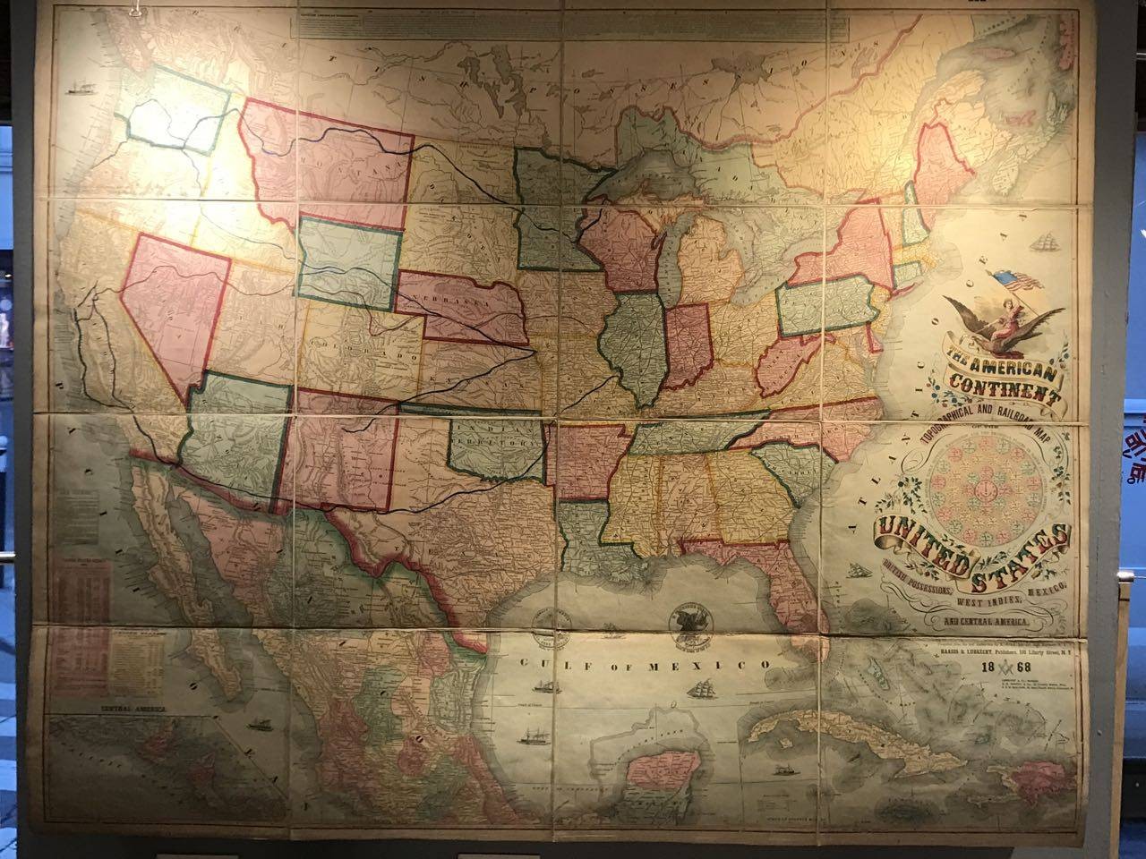
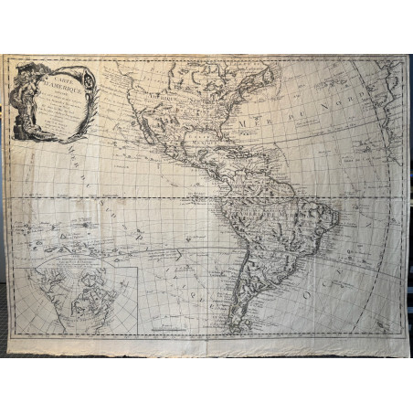
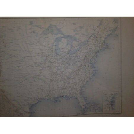
The American Continent, topographical and railroad map of the United States, with British possessions, West indies, Mexico, and Central America compiled from the best authorities by R.Rosa, late col, 46th Regiment N.Y.V

Haasis and Lubrecht Publishers, 108 Liberty street, New Yorck

1868

Immense carte des états unis et des chemins de fer éditée en 1868, par Haasis et Lubrecht, coloris anciens, carte anciennement découpée et collée sur une toile de lin pour faciliter la manipulation.très bel état.

dim 99 X 122 cm

Figure dans le superbe cartouche les distances et temps de trajets en train entre les villes

WPAM22
 

Paiement sécurisé


Livraison dans le monde entier


Retour sous 14 jours (à votre charge)

8 autres produits dans la même catégorie :